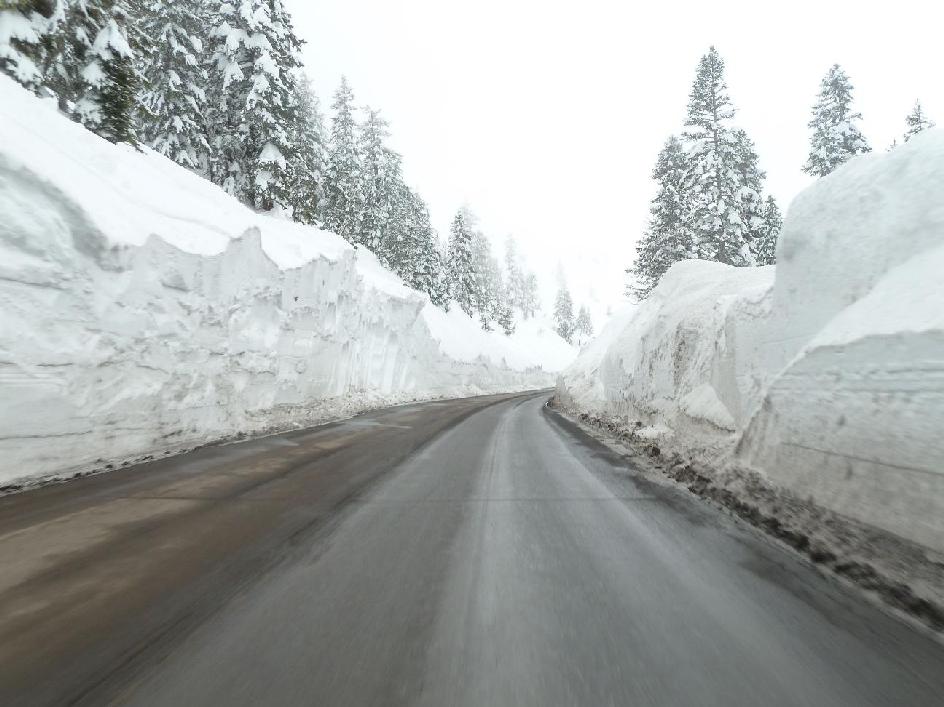
This post is about your work around Tahoe, and what you can do to improve. First, I need to state that Caltrans folks who clear the roads day and night in sometimes horrid conditions, have a very hard job. In my experience with Tahoe, they actually do a good job with keeping roads open in bad conditions with the resources they have.
Yet, they could definitely do better. By that, I don't mean work harder, I'm pretty sure they already work hard during the big snow storms (especially the ones we had this year), I mean by improving communication.
In a nutshell, as much as you do a good job with roads, you do quite poorly with communication. This is partly why I wrote my "Tahoe Road Info for SR88 (kirkwood), US50 (South Lake Tahoe), and I80 (North Lake Tahoe) or making caltrans road reports more liveable" page. But my page is just making the online caltrans info a bit more useful, it does not fix underlying problems with how you communicate (or don't communicate in many cases).
Why the goals below are worth following
1. By increasing the frequency and standardizing the format of online updates, Caltrans could improve road safety by redirecting travelers towards the safest roads where Caltrans has the largest crew working.2. A good example of providing realtime updates to a time sensitive real world situation is: http://www.google.com/crisisresponse/japanquake2011.html#map. This includes visualization and real-time social updates (if you had a twitter hash tag, then some drivers would probably update this info in real time for you!).
3. Your audience increasingly uses the desktop internet and mobile devices to get information, and this peaks during winter driving times (700x growth from baseline!).
4. Improve communication and increase driver safety, as per your mission statement on http://www.dot.ca.gov/hq/paffairs/about/mission.htm
5. Not that your main goal should be to have a better web site that other states like Utah, or Nevada, but being far behind them is obviously a sign that things should be better. See for example:
6. Put an end to road user frustration and anger that were avoidable.
So, how do you get there?
Target Goals
Let me summarize my suggestions here:1. Report tentative/planned status changes.
2. Report actual road status changes as quickly as possible.
3. Maintain a history of status changes, in addition to current status report.
4. Standard format for status reports (i.e. computer parsable) and a graphical map with summary view.
5. A blog like page where you tell us about the challenges you're facing with your job, like why you can't plow a road because of conditions or because your equipment is tied up elsewhere (that's just for extra points)
So, let's start with my #1 suggestion:
Caltrans: you should announce tentative road changes, and report road changes as quickly as practical, and reliably
To give you credit, I've seen two instances where you did over this ski season:
Now, let's look at a sample of the many instances of what you've done badly with communication:
In just one 10 day period, I noted 5 different examples where the Caltrans web site failed to note some road changes, or did it very late, 4 of them were just in 3 consecutive days (!).
Caltrans, you work hard on keeping roads open, or re-opening them, but I beg you: you *really* need to communicate what you're doing.
Of course, you can't be everywhere all the time, use us, drivers, on roads that have cell service at least (won't help with hwy88, but at least it will for others), and use us to report up to date problems, accidents and road closures online quicker than you can when applicable.
Caltrans blog for each road
Here's my suggestion to you Caltrans: for each road you should have a blog-like page announcing what your plans are for a given road. You obviously have guys who figure out whether they're going to try and re-open Carson Spur on 88, or how long you think you'll keep it open. You also know if 50 and 80 are in such a bad shape that you had to send all your equipment there and therefore you won't be able to work on 88 anytime soon. So:Blog it
I'm not trying to get you to go social because it's cool. I don't care much for facebook or twitter, but please find a way, any way, to let us know what your intentions are. I'm not asking that you tell us that you'll reopen the Spur at 08:22 tomorrow morning, I'm just asking for:
IS REOPENED FROM KIRKWOOD (AMADOR CO) TO 5 MI WEST OF PICKETTS JCT (ALPINE CO) AT 0828 HRS ON 3/25/11
Also, the reason why I mentioned a blog-like page, is because it's worthwhile for us to know what you've done in the last days or the last week. It's even useful when you close a road to know how long ago you closed it: for instance when you closed 50 for avalanche control as I was driving up, it was useful for me to know (through my own page, not yours), that you had closed it 1H ago and guess that it'd probably reopen 2H after it was closed, which it did.
I did that part for you by scraping your web page and keeping history for me and others, but you really should do this yourselves. See: http://marc.merlins.org/snow/roadinfo/sr88
More user friendly as well as computer parsable status reports
Another reason why I created this page http://marc.merlins.org/snow/tahoe_caltrans.shtml is because how are we supposed to know where "Peddler Hill" or "Nayak" (really Nyak) are? Telling us a road status between points that most road users don't actually know, isn't useful.
Would it be so hard to give us a graphical map like what Nevada DOT tries to do by parsing your free form text data: http://www.safetravelusa.com/nv/?map=Sacramento ?
I personally have 4 months worth of data from you, and you can tell it's free form text entered by a human. There are some patterns but really it seems to depend on the operator and it's nothing that's easy to parse for computer for any kind of automation. As result, Nevada DOT has even showed incorrect road status for California on the graphical map because they couldn't parse your data properly.
What should you do? Well, I recommend that part of your reports be made out of drop downs so that the format is guaranteed to be the same at all times, and then the operator can add free form text that is useful to humans at the end without compromoizing the computer parsable section at the beginning. As an example to others, those are examples I've seen:
IS CLOSED 1.5 MI WEST OF KYBURZ
IS CLOSED FROM TWIN BRIDGES TO MEYERS
IS CLOSED TO WESTBOUND TRAFFIC AT 4.8 MI WEST OF STRAWBERRY
IS CLOSED FROM ECHO SUMMIT TO MEYERS
IS CLOSED TO EASTBOUND TRAFFIC FROM COLFAX (PLACER) TO THE NEVADA STATE LINE
So, we have 'AT X', 'From X to Y', 'TO traffic AT X', and even 'TO traffic FROM X TO Y', and probably a few more. Then a road can be CLOSED or have 'TRAFFIC HELD', which quite frankly are the same in real life, but you seem to use one or the other depending on the road for some reason.
Also sometimes you send a 'CLOSED AT 21:22' and then replace it with 'CLOSED' 5mn later. Sometimes you never send the 'AT XX:YY', so computer algorithms can't do much with data that is randomly missing.
My point is that all this could be simplified and be made more consistent. Please do what you can there.
Conclusion
Thanks for doing a lot to keep our roads open as much as possible during bad weather. Your Tahoe staff does do pretty incredible work. But please: let us know what you're doing, and maybe even give us some insight about how you're working on the roads and what you're dealing with.
This was a busy year, especially for March
Thanks,
Marc

")


")


")
")


")


")


")


")


