Tahoe Road Info for SR88 (kirkwood), US50 (South Lake Tahoe), and I80 (North Lake Tahoe)

or making caltrans road reports more livable

See this link for more details of the problems with Caltrans Communication.

Purpose

This page helps with the following things:

Latest sr88, sr89, us50, and i80 STATUS

2013:05:06 08:44 Status for sr88 from http://www.dot.ca.gov/hq/roadinfo/sr88:
[IN THE CENTRAL CALIFORNIA & SIERRA NEVADA] 1-WAY CONTROLLED TRAFFIC AT VARIOUS LOCATIONS FROM THE AMADOR/ALPINE CO LINE TO 5 MI WEST OF PICKETTS JCT (ALPINE CO) FROM 0800 HRS TO 1600 HRS WEDNESDAY THRU THURSDAY THRU 5/9/13 - DUE TO MAINTENANCE

2013:05:14 16:07 Status for us50 from http://www.dot.ca.gov/hq/roadinfo/us50:
[IN THE NORTHERN CALIFORNIA AREA] 1-WAY CONTROLLED TRAFFIC 7 MI WEST OF KYBURZ /AT WHITEHALL CANYON DR/ (EL DORADO CO) - DUE TO AN ACCIDENT

2013:05:19 20:58 Status for i80 from http://www.dot.ca.gov/hq/roadinfo/i80:
[IN THE SAN FRANCISCO BAY AREA - SOLANO CO] A HIGH WIND ADVISORY IS IN EFFECT AT THE SAN FRANCISCO-OAKLAND BAY BRIDGE /IN SAN FRANCISCO/ (SAN FRANCISCO,ALAMEDA CO) - TRAVEL IS NOT RECOMMENDED FOR CAMPERS, TRAILERS OR PERMIT LOADS
[IN THE NORTHERN CALIFORNIA AREA & SIERRA NEVADA] A HIGH WIND ADVISORY IS IN EFFECT OVER THE YOLO CAUSEWAY & OVER THE BRYTE BEND BRIDGE /WEST OF SACRAMENTO/ (YOLO CO)

2013:05:08 10:16 Status for sr89 from http://www.dot.ca.gov/hq/roadinfo/sr89:
[IN THE CENTRAL CALIFORNIA AREA & SIERRA NEVADA] NO TRAFFIC RESTRICTIONS ARE REPORTED FOR THIS AREA.
[IN THE NORTHERN CALIFORNIA AREA & SIERRA NEVADA] IS CLOSED FROM THE LASSEN VOLCANIC NAT'L PARK SOUTH BDRY TO THE JCT OF SR 44 /LASSEN LOOP/ (TEHAMA, SHASTA CO) - FOR THE WINTER - MOTORISTS ARE ADVISED TO USE AN ALTERNATE ROUTE
1-WAY CONTROLLED TRAFFIC AT VARIOUS LOCATIONS FROM 4.6 MI NORTH TO 6 MI NORTH OF BLISS STATE PARK (EL DORADO CO) FROM 0800 HRS TO 1600 HRS TUESDAY THRU WEDNESDAY THRU 5/8/13 - DUE TO MAINTENANCE
1-WAY CONTROLLED TRAFFIC AT VARIOUS LOCATIONS FROM THE EL DORADO/PLACER CO LINE TO 4.2 MI NORTH OF THE EL DORADO/PLACER CO LINE 24 HRS A DAY FROM 0600 HRS MONDAY THRU 1200 HRS FRIDAY THRU 1/1/16 - DUE TO PERMIT WORK - MOTORISTS ARE SUBJECT TO DELAYS OF UP TO 20 MINUTES

Latest sr88, sr89, us50, and i80 UPDATE

2013:05:06 08:44 change for sr88 from http://www.dot.ca.gov/hq/roadinfo/sr88:
-[IN THE CENTRAL CALIFORNIA & SIERRA NEVADA] CHAINS OR SNOW TIRES ARE REQUIRED FROM SILVER LAKE TO 3.5 MI EAST OF SILVER LAKE (AMADOR CO)

2013:05:14 16:07 change for us50 from http://www.dot.ca.gov/hq/roadinfo/us50:
-[IN THE NORTHERN CALIFORNIA AREA] REOPENED TO 1-WAY CONTROLLED TRAFFIC 7 MI WEST OF KYBURZ /AT WHITEHALL CANYON DR/ (EL DORADO CO) AT 1600 HRS ON 5/14/13 - DUE TO AN ACCIDENT

2013:05:19 20:58 change for i80 from http://www.dot.ca.gov/hq/roadinfo/i80:
-[IN THE SAN FRANCISCO BAY AREA - SOLANO CO] IS CLOSED TO EASTBOUND TRAFFIC AT SUISUN VALLEY RD /IN FAIRFIELD/ (SOLANO CO) - DUE TO AN ACCIDENT - MOTORISTS ARE ADVISED TO USE AN ALTERNATE ROUTE

2013:05:08 10:16 change for sr89 from http://www.dot.ca.gov/hq/roadinfo/sr89:
-[IN THE CENTRAL CALIFORNIA AREA & SIERRA NEVADA] IS REOPENED FROM THE JCT OF US 395 (MONO CO) TO THE JCT OF SR 4 /MONITOR PASS/ (ALPINE CO) AT 1000 HRS ON 5/8/13

Get real time sr88, sr89, us50, and i80 changes via Email

You can subscribe to one or more of those lists (or the last one for all):

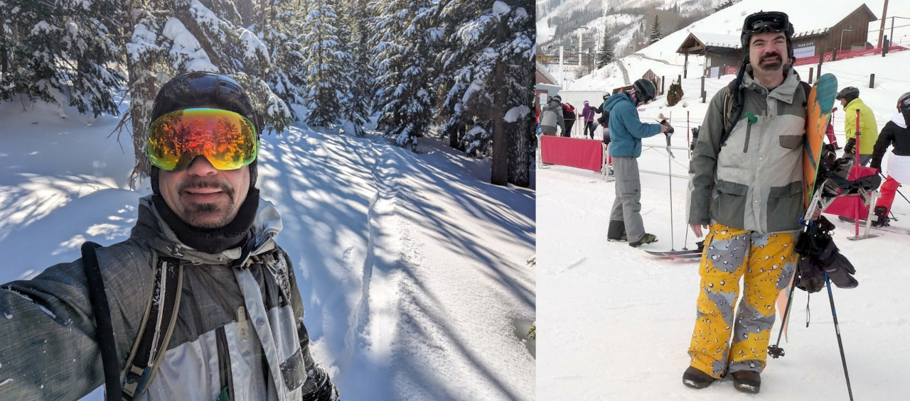
This is an Email example (notice the - and + to show the state change):

Update in http://marc.merlins.org/snow/roadinfo/sr88/ : 2010:12:05 03:55

Change since last update:
-[IN THE CENTRAL CALIFORNIA & SIERRA NEVADA] CHAINS ARE REQUIRED ON ALL VEHICLES EXCEPT 4-WHEEL-DRIVE VEHICLES WITH SNOW TIRES ON ALL 4 WHEELS FROM 3.5 MI EAST OF SILVER LAKE (AMADOR CO) TO PICKETTS JCT (ALPINE CO)
-CHAINS OR SNOW TIRES ARE REQUIRED FROM PICKETTS JCT TO 1 MI WEST OF WOODFORDS (ALPINE CO)
+[IN THE CENTRAL CALIFORNIA & SIERRA NEVADA] CHAINS ARE REQUIRED ON ALL VEHICLES EXCEPT 4-WHEEL-DRIVE VEHICLES WITH SNOW TIRES ON ALL 4 WHEELS FROM 6.5 MI EAST OF PEDDLER HILL TO KIRKWOOD (AMADOR CO)
+CHAINS OR SNOW TIRES ARE REQUIRED FROM KIRKWIOD TO 1 MI WEST OF WOODFORDS (ALPINE CO)

New state from http://www.dot.ca.gov/hq/roadinfo/sr88
[IN THE CENTRAL CALIFORNIA & SIERRA NEVADA] CHAINS ARE REQUIRED ON ALL VEHICLES EXCEPT 4-WHEEL-DRIVE VEHICLES WITH SNOW TIRES ON ALL 4 WHEELS FROM 6.5 MI EAST OF PEDDLER HILL TO KIRKWOOD (AMADOR CO) CHAINS OR SNOW TIRES ARE REQUIRED FROM KIRKWIOD TO 1 MI WEST OF WOODFORDS (ALPINE CO)

Main page with google maps of Caltrans reporting points:
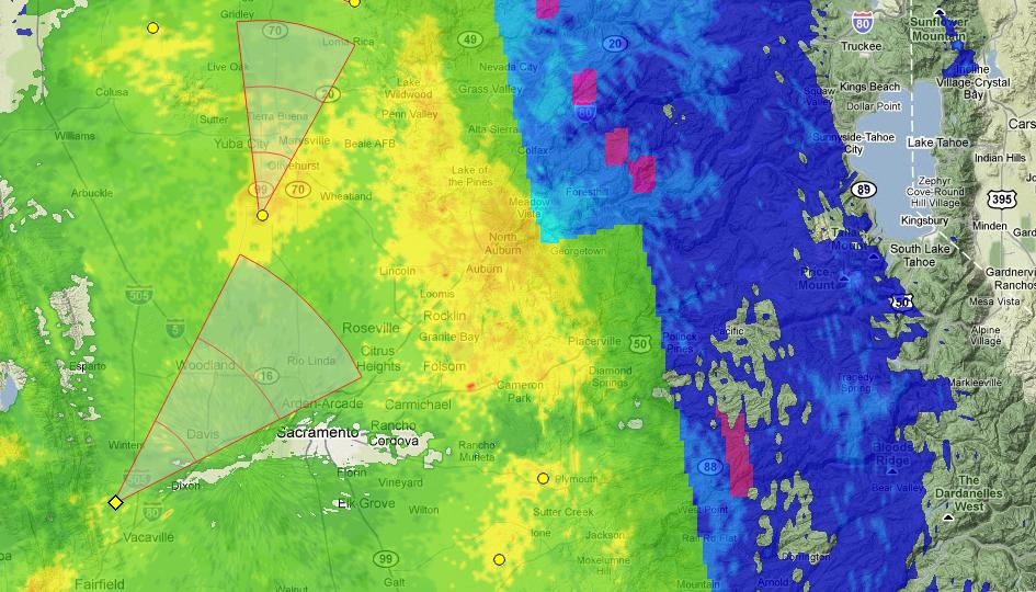
http://marc.merlins.org/snow/tahoe_caltrans.shtml


Google Maps


Unfortunately Google broke my map with all caltrans reporting points. You have to click on this link to the maps to see it in another window.

Change history

It's not fancy, but I'm providing it in text form for you to download/parse if you wish: Tahoe Road Info History

Other sources of data

Magnifeye is a nice site if you're mainly interested in hwy 80 and hwy 50 (pretty useless for hwy 88/kirkwood).

Weather Underground Nexrad

Weather underground makes a pretty kick ass nexrad map for real time conditions:

As an example, this is what it looks like on a 'good' day :)


Graphical Map from Caltrans

Caltrans has a map that is useful to showing chain signs and some CHP incident info with graphical location (click CHP incidents and Chain Controls).

Graphical Map from Nevada DOT

Nevada DOT has a nice graphical map that Caltrans could learn from. They do include the CA side of the roads you care about (click on the map to get an interactive one where you can mouse over portions of roads for more details)
Understand that their map based on mostly unparseable Caltrans text data with typos and no rules, and therefore it is unfortunately wrong on occasion.


FAQ

Can you support more roads/how do I run this myself?
I'm not really planning on adding more roads, but you're welcome to use my code to do your own: roadinfo script.


[ms free site] Email
Link to Home Page